
Drawing the inaccessible bus stops of Metro Transit, part II
Documenting issues old and new with Madison’s public transit system.
Documenting issues old and new with Madison’s public transit system.
In July 2023, I began drawing inaccessible bus stops to highlight the failures and oversights within Madison Metro’s bus system. I documented bus stops I encountered on my regular routes and solicited photo submissions from community members who identified more inaccessible stops. I received several submissions, including stops that let riders out in the middle of streets due to construction, stops with trash cans blocking the pavement, and stops without bus shelters or curb cuts. I also began documenting stops that had closed down during Madison Metro’s redesign, which included many stops near low-income neighborhoods or near critical services. I not only wanted to highlight long-standing issues with the bus accessibility but also new issues that have arisen due to the redesign.
It is now nine months into Madison Metro’s bus system redesign, which the city claimed would benefit low-income people and people of color and improve access to “jobs.” While some bus stop issues highlighted in this series are a direct result of the redesign—like closed down stops and increased walking distances to community resources and housing—other issues, like lack of snow removal, have been long-standing.
Below are six more inaccessible bus stops. I want to continue to document more inaccessible bus stops, so if you see one please email a photo to rdlitchman@yahoo.com with the location of the stop. To bring up these issues to the City of Madison, you can email transportationcommission@cityofmadison.com. There is also now a survey targeted at disabled users of Metro Transit for people to provide feedback on inaccessibility.
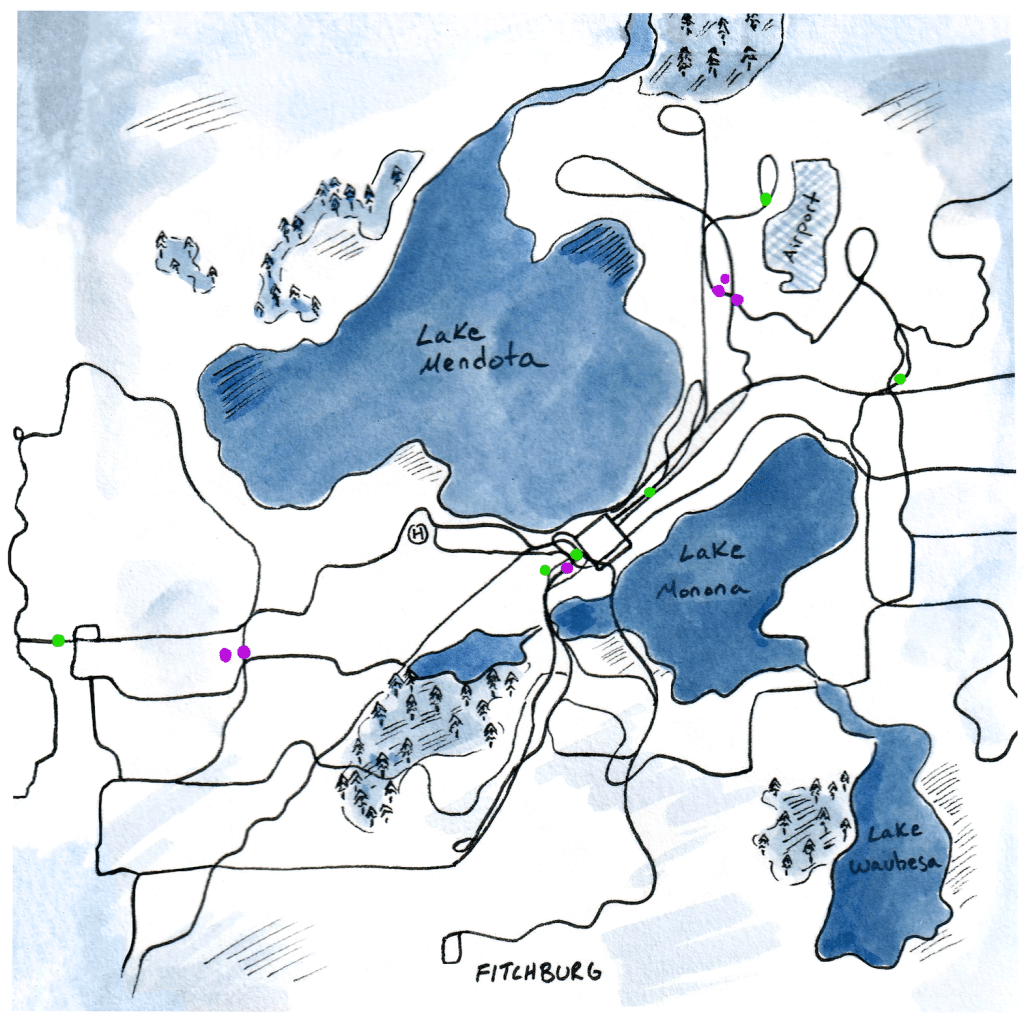
Map:
This map shows the locations of the inaccessible bus stops I have documented so far. Bus stops from my previous series are identified by a pink dot. Bus stops from this current series are identified with light green dots. The hyperlink within each title will take readers to an exact location on the City of Madison’s transit map. There is no link for the stop by the Triangle Neighborhood, since it has been closed down.
The Triangle Neighborhood Bus stops:
The Triangle Neighborhood is a neighborhood in the Greenbush area near Meriter Hospital. It contains four public housing projects that house low-income, disabled, and elderly adults and families. The bus system redesign closed down all stops that passed through this street but did not close down the several other stops on West Washington proceeding these stops. The stops on West Washington that were not closed pass through an area that has been rapidly redeveloped with luxury student housing. The new route E turns before reaching the Triangle neighborhood, bypassing the public housing entirely.
Mineral Point at South High Point, Eastbound, Route A:
This stop is across from a dental clinic. In order to access the bus stop from across the street, riders have to cross the street three times to get around construction. The street crossing to get to the bus stop is dangerous, filled with holes and equipment in the middle of the road, blocking the crosswalk.

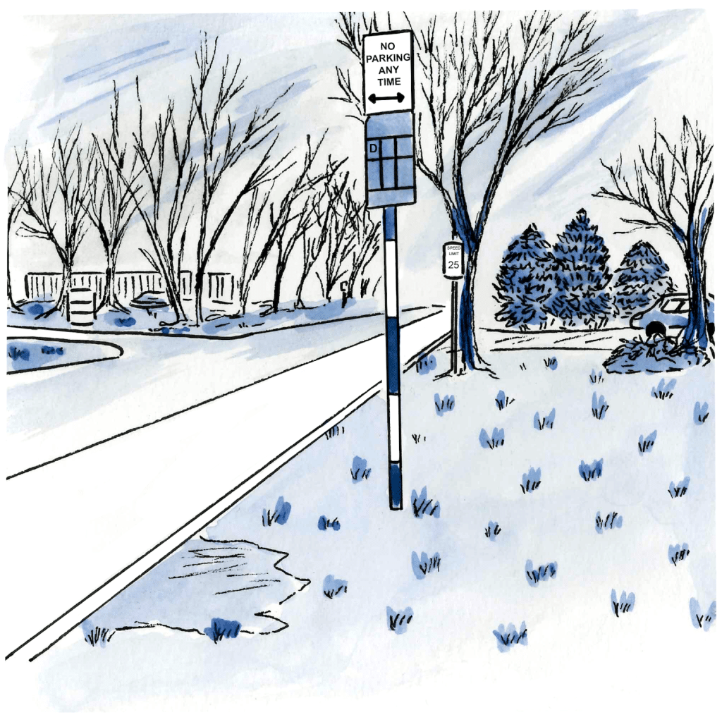
Darwin at International, Westbound, Route D:
Like many of the new bus stops, this stop lacks a boarding platform or sidewalk, meaning riders with disabilities are left without a place to easily board or deboard the bus. This stop is now the closest stop to a number of nonprofits, including Outreach LGBT community center, EmployAbility, and Anesis Therapy. The stops closer to these non-profits were removed, increasing walking distance and making access extremely difficult for people with mobility aids or challenges.
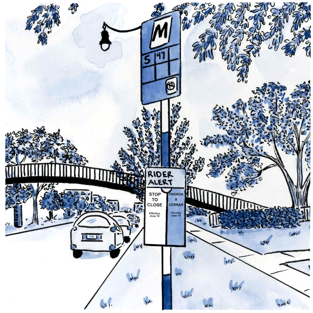
East Washington at North Paterson, Route A, B:
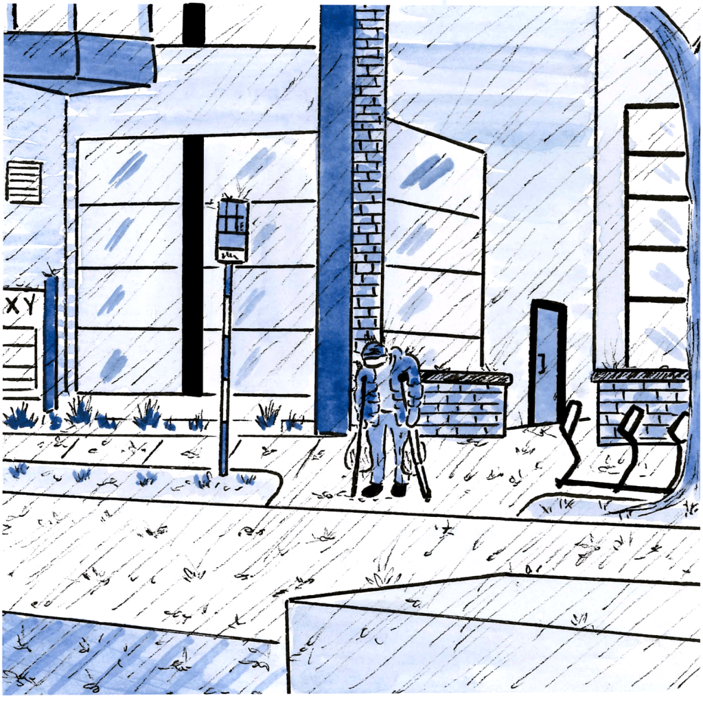
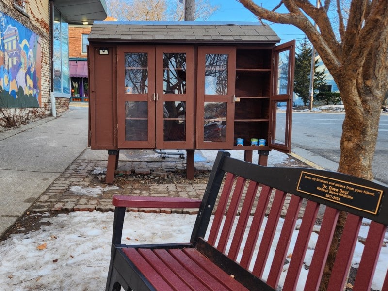
This bus stop lacks adequate shelter and seating. According to Marina Drake, who published a photo of this stop in the Dane County Neighbors Helping Neighbors Facebook group, “We need more City of Madison Metro Transit bus stop shelters and benches, BRT or no BRT. This was yesterday, someone on crutches standing in the pouring rain in front of a prime example of the unaffordable housing going up all over town.”
Dempsey at Milwaukee, Route G eastbound:
“There’s two buses that, on paper, should make for easy transfers,” Kmej (who asked to be identified by a pseudonym) says about the inaccessibility of this stop near Woodmans. “The first one goes down Milwaukee and turns right on Demsey. The other comes up Demsey and turns right on Milwaukee. That intersection is highly dangerous because of the way people drive right there, there’s not enough room, and people are forced to weave through backed up cars who are trying to merge into a four-lane [street].”

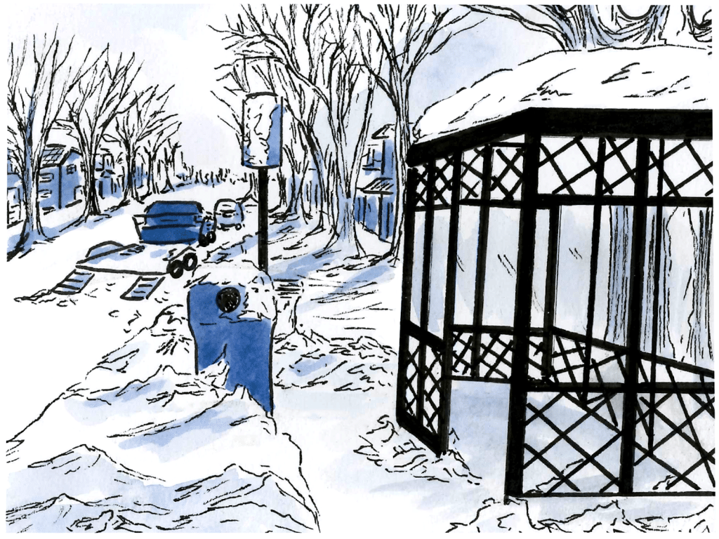
West Washington at North Bassett, Westbound, Route E, 75
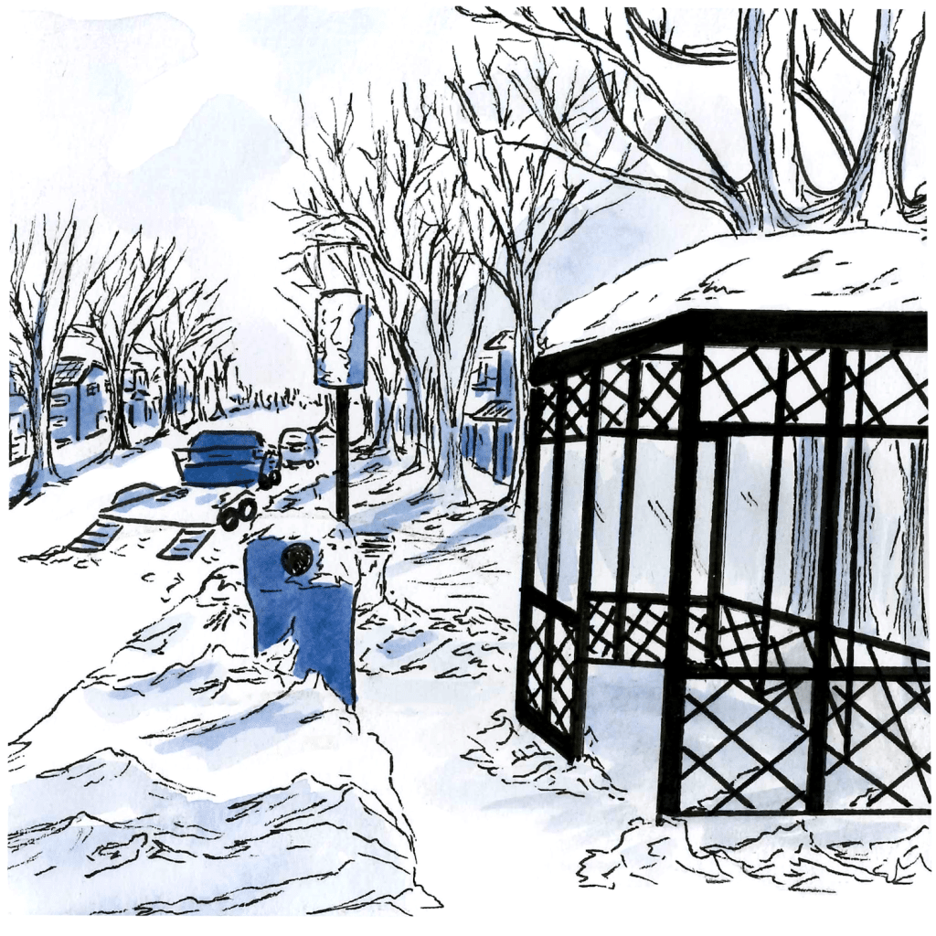
Finally, the city has long had issues with timely snow-removal at bus stops, if at all. The photo of this bus stop was taken several days after the winter storm on January 12-13. While the stop itself had been plowed, the snow plows on the street had pushed snow back up in a pile in front of the curb cut. Additionally, snow had frozen onto the sign, blocking the name of the route. Since Metro has largely (if not completely) removed transit maps from bus stops, it’s hard to tell what routes this stop services without access to a phone.
Tone Madison wants to continue publishing this series but we need your help! Send photos of inaccessible bus stops to rdlitchman@yahoo.com with the location of the stop.
To bring up these issues to the City of Madison, you can email transportationcommission@cityofmadison.com. You can also provide feedback directly to Metro Transit.
Who has power in Madison,
and what are they doing with it?
Help us create fiercely independent politics coverage that tracks power and policy.
Author

Related Articles
Starter homes? No, we need starter apartments
As homeownership continues to be out of reach for too many Madisonians, we should build more owner-occupied, multi-family housing.
The federal war on trans healthcare mirrors that of abortion
Hospitals are folding to anti-trans hate, but the community continues to advocate for trans youth.
Madison needs a wake-up call
The longer we pretend this City is a progressive haven, the more people will be harmed.